|

|
|
|
|
|
|
|
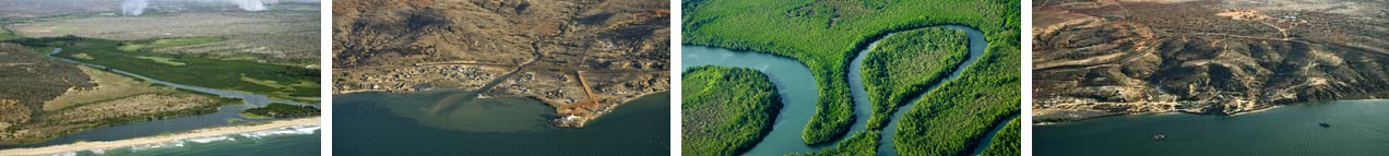
In order to supply additional visual information on a project's area, MDVIA produces oblique aerial photos of selected areas. These photos can be used to assess a project's advancement as well as to provide elevation data that can be used as a basis for 3D modeling.
MDVIA utilizes top of the line systems in order to produce two types of oblique photography products: object-targeted photos and panoramic view of the area. Oblique photography products are geo tagged and are easily incorporated into our GIS systems in order to provide better understanding of a project's area. The entire production process from planning via raw data processing to the final product , as well as logistical aspects of the production, is conducted by MDVIA.
MDVIA has gained valuable knowledge and experience in producing these photos in several projects around the world such as, a 700 km strip of Angola's shoreline and commercial centers constructions in Israel.
|
|
|
|
|
|