|

|
|
|
|
|
 |
|
|
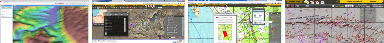
Based on advanced GIS tools, WEB technologies and accurate geo - information, the Baobab GIS is designed to serve in two scopes:
1. Spatial planning tool.
2. Spatial project management tool.
Baobab GIS that was developed by MDVIA, provides the operating companies, project managers and business partners, capabilities to create an effective and coordinated plan, to geographically monitor progress and the possibility of early detection of field based challenges and obstacles in almost real time, leading to on the spot accurate control an improved decision making. In addition, the system enables terrain visualization and analysis in advance and dramatically minimize unnecessary costs. It also affects HSE issue: it reduces to minimum environmental impact, decreases safety risks, and supports fast rescue in case of injury.
In the process of developing the Baobab GIS, MDVIA combines advanced technology along with multiple capabilities and expertise in a verity of fields both in the field and in the office. The development process includes extensive data collection from already available sources as well as new data collected by air and ground teams. The data is then processed and added to a geodatabase. Meanwhile, a WEB environment for the database specifically tailored to the client's needs. After the initial setup of the system, daily updates are added to the geodatabase in order to allow the client to keep up as the project progresses.
The Baobab - GIS was developed from MDVIA's extensive expertise and deep know - how in field operations (scouting, surveying and mapping), for the last 25 years. The system has already been successfully implemented in several oil and gas projects in Angola, showing dramatic improvement in time reduction in the planning and execution of the project, and in enabling to proactively manage the project with better decision making due to its real time updates, visualization and analysis tools.
|
|
|
|
|
|