|

|
|
|
|
|
|
|
|
An effective tool to monitor and manage assets, teams and activities can greatly benefit any company or organization. This can be achieved by using a custom designed Geo-information system, which will include a database of the required geographic and other information, together with optimal tools to update, manage, query and analyze this database. In this way the decision-making process is shortened, greater control is attained and substantial financial savings can be achieved.
|
|
|
|
|
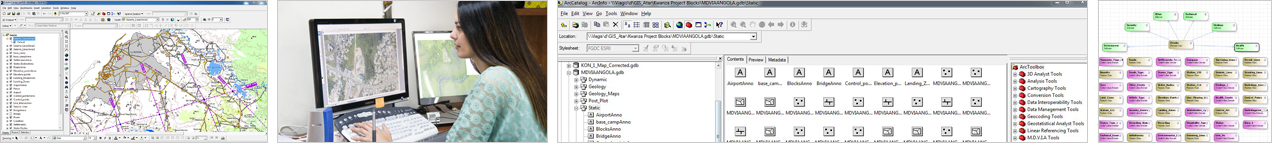
MDVIA offers a service of designing and constructing GIS – Geographic Information Systems, custom made for the client’s requirements and characteristics.
Our team of experienced GIS professionals will first meet with the client and accompany his activities in order to acquire a profound understanding of his needs. Based on this knowledge and any further requests by the client our experts will design the GIS scheme, including database structure and specific tools, which will best improve the client’s workflow and management efficiency. Upon the client’s approval of the proposed GIS our team will construct and populate the database, while the planned GIS tools are being prepared and adapted. Next, our experts will provide support and training while the GIS is being deployed and implemented at the client’s site.
Optionally, a synchronized Mobile GIS aspect can be added to the system, where by using mobile computers and an innovative, real-time application, the GIS can be taken to the field. This allows the client to use his GIS in the field, and may permit collecting new data for updating the database.
|
|
|
|
|
|
|
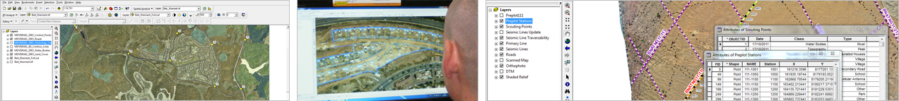
MDVIA offers a professional service of designing and creating custom made databases, using all types of information sources, from existing digital and paper data in all formats to new information produced and collected according to the client’s needs. Our professional GIS personnel uses the latest geographic software to convert and edit digital information, as well as perform digitization of entities and information based on raster data (scanned map or Orthophoto), and representation as vector layers. The entities and information can be of virtually unlimited number of types, such as roads, property boundaries, points of interest, natural habitats etc. All these raster and vector layers will be merged into a custom built database, which will offer easy access and presentation, allow efficient creation of new mapping products, as well as integration into a full GIS for more effective and dynamic visualization and use of the data.
MDVIA has gained extensive knowledge and experience in managing and producing geographic layers and databases for various uses around the world.
|
|
|
|
|
|
|